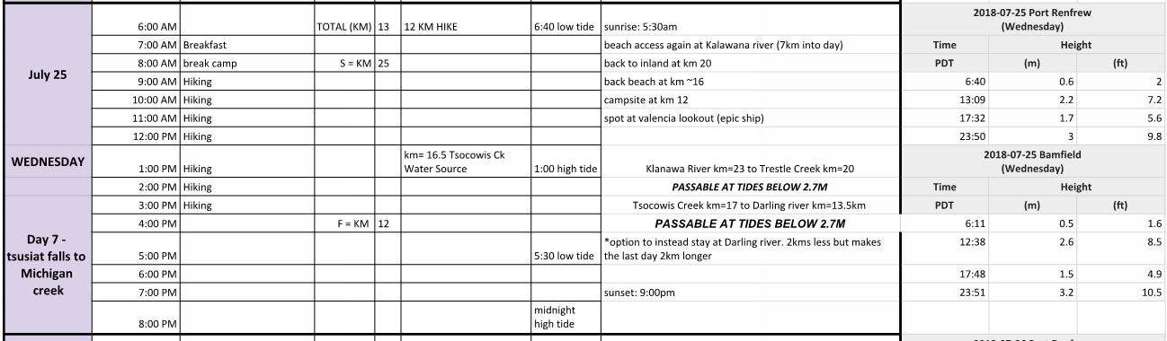
- Date Completed: Wednesday 2018 July 25
- Distance (According to GPS): 13.2 km
- Time: 4 hr 39 min
- Elevation Gain: + 585m – 544m
- West Coast Trail KM’s: KM 25 to KM 12
- Map of the Route & GPS data: Yes!! Click here for Route
- Best Description of the Day: Eye of the Tiger
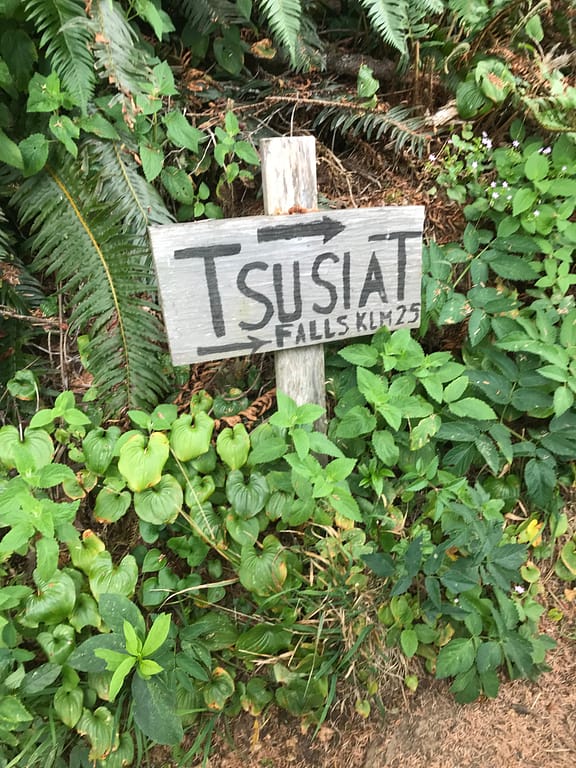
Day 7 Log of the Journey – Tsusiat Falls to Michigan Creek
I’m a bit old school with tracking our adventures in my Moleskin Notebook.

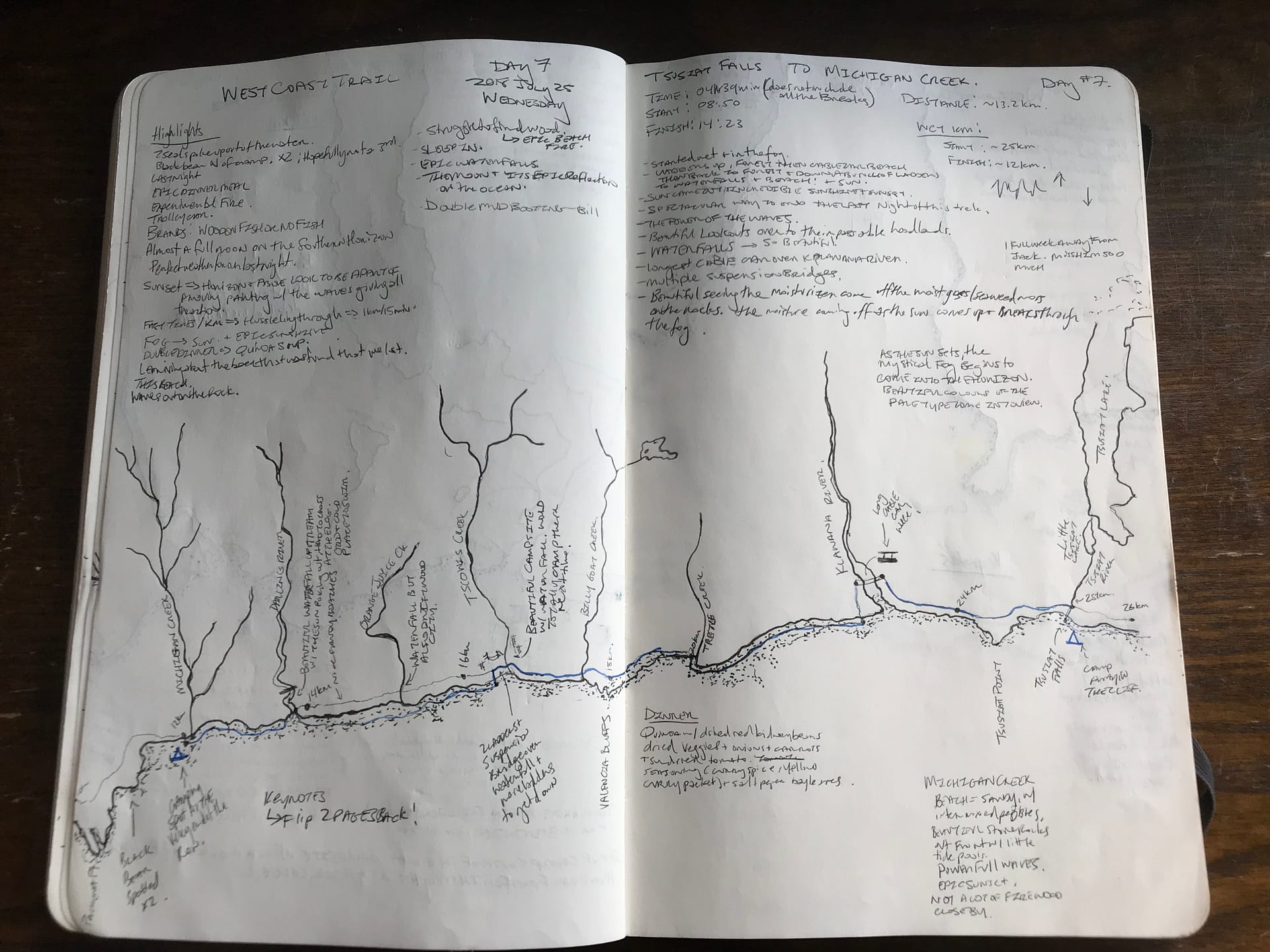
Day 7: Tsusiat Falls to Michigan Creek – 2018 July 25
06:30ish I think….wake up, pack up and LAST FULL DAY ON THE TRAIL
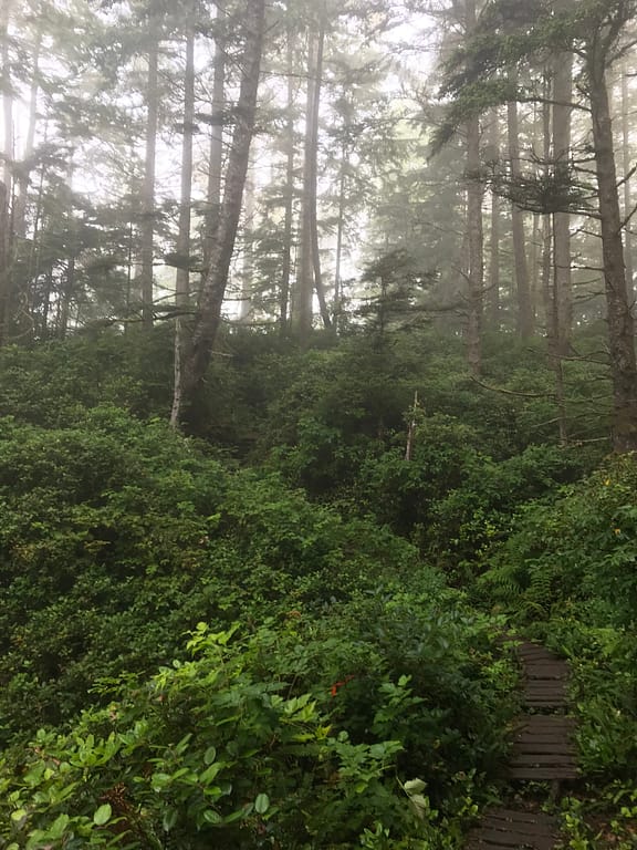
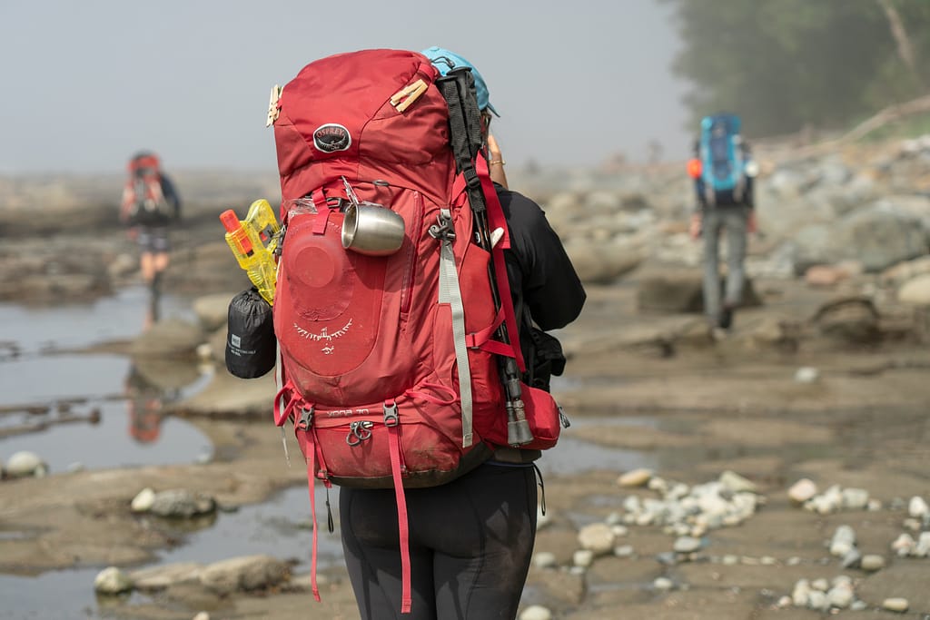
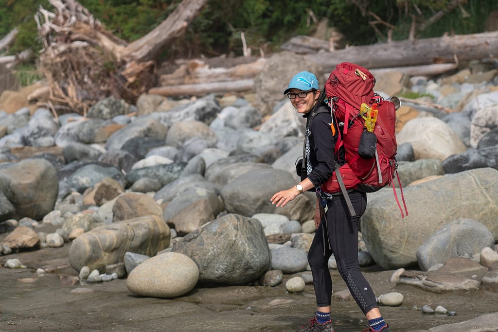
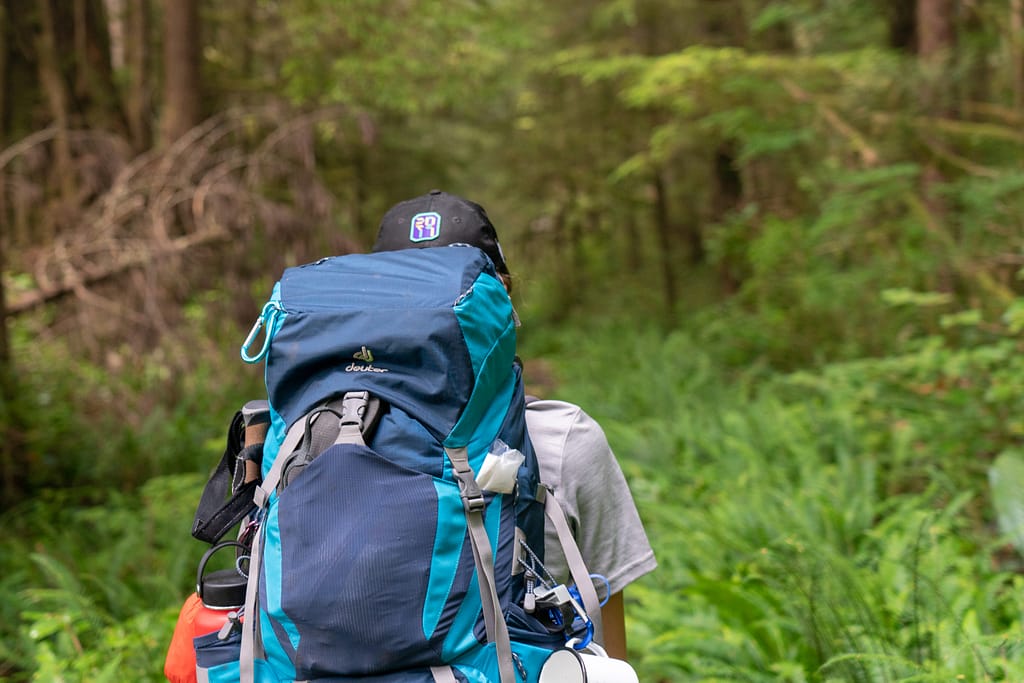
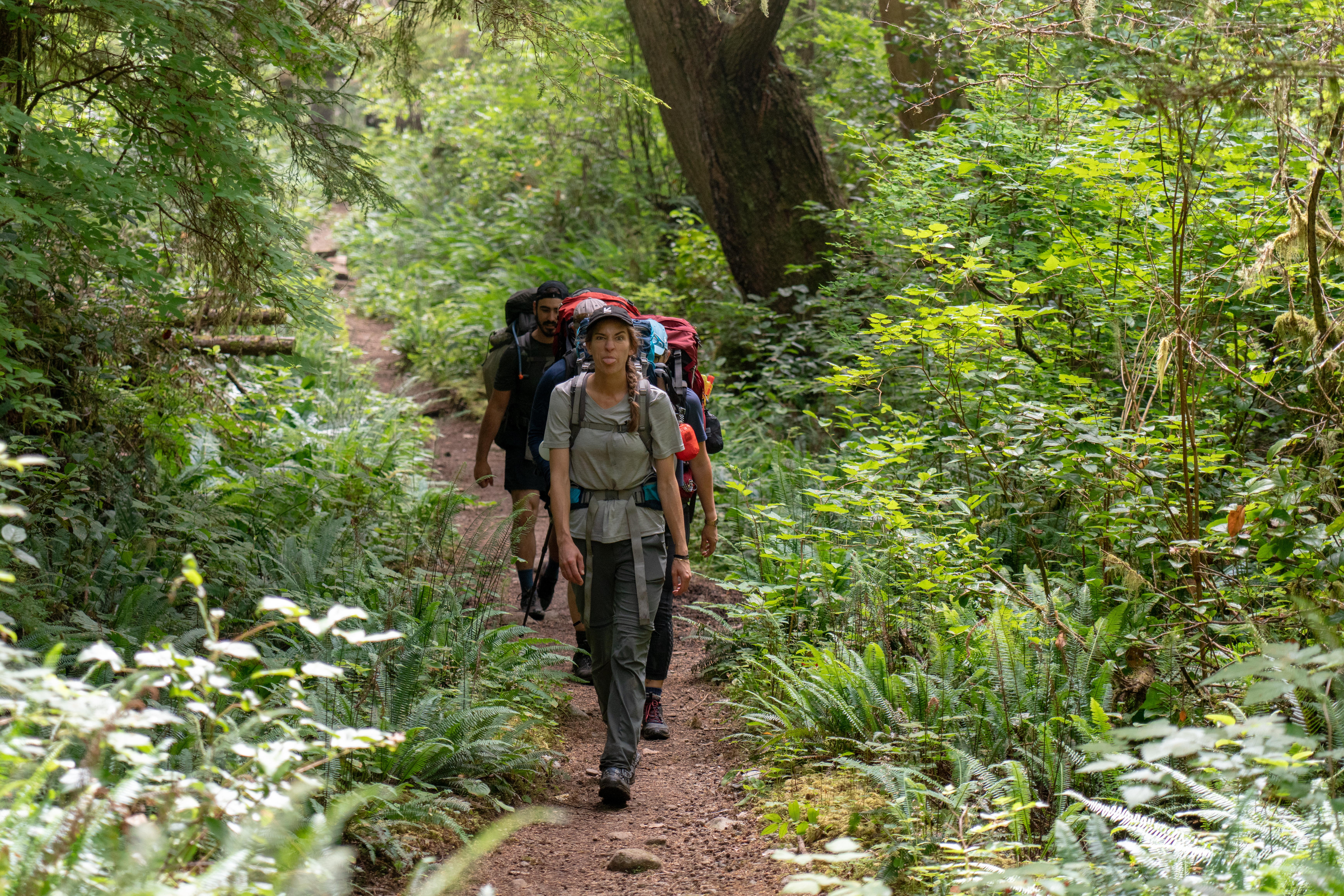
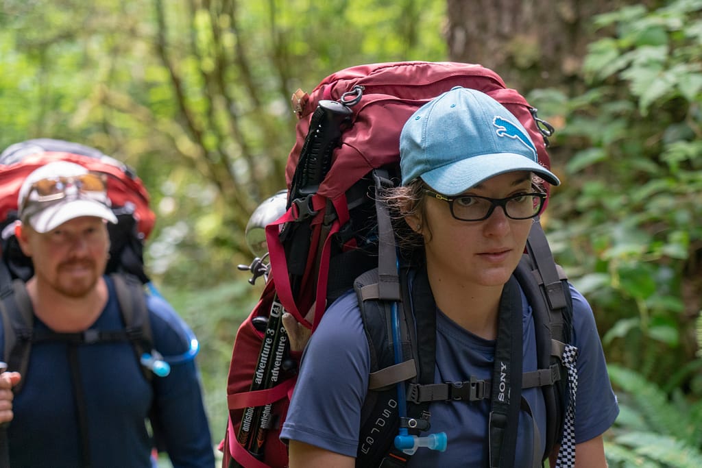
We all decided to sleep in today, as the schedule for the day was not reliant the tide tables. This made for a nice change of events. The plan was to hike towards WCT KM 15 or somewhere in that near proximity. The morning is foggy and damp. Definitely wearing the comfy quick dry clothes and my waterproof boots. We drink our coffee, I stared in aww at the waves crashing in. Seriously, one of my favourites. We packed up and were ready to head off for the day.


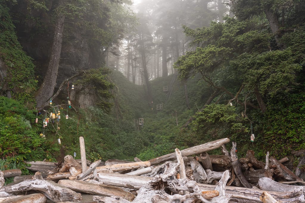
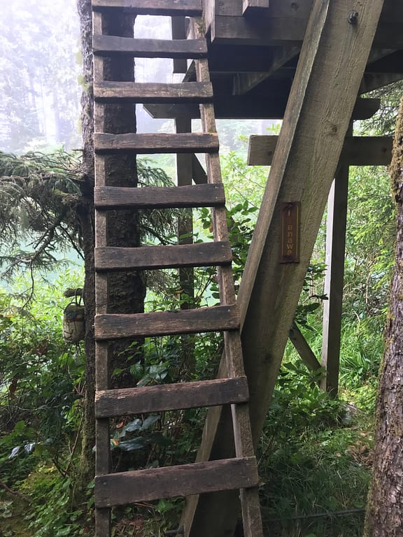
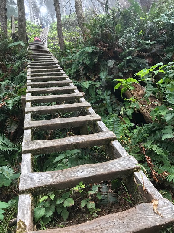
We walked back towards the falls, and looked at the fun ladders we get to climb up. The light in behind the ladders provided a beautiful backdrop.
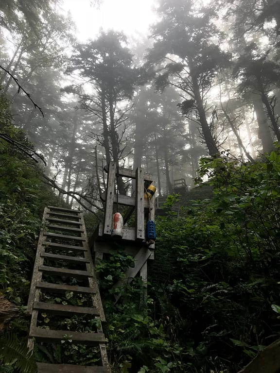
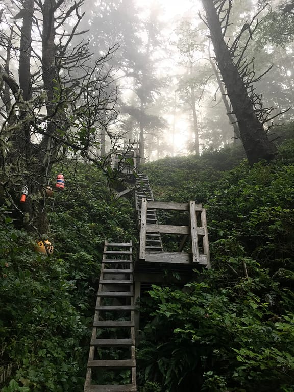
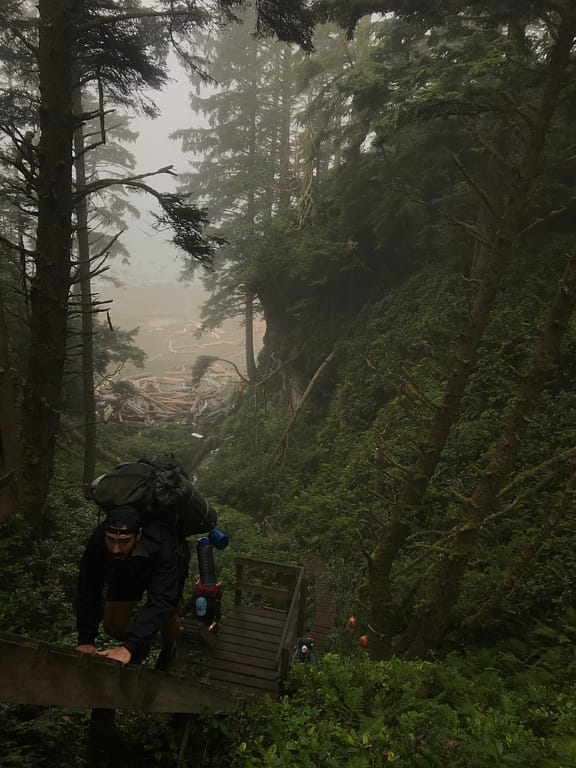
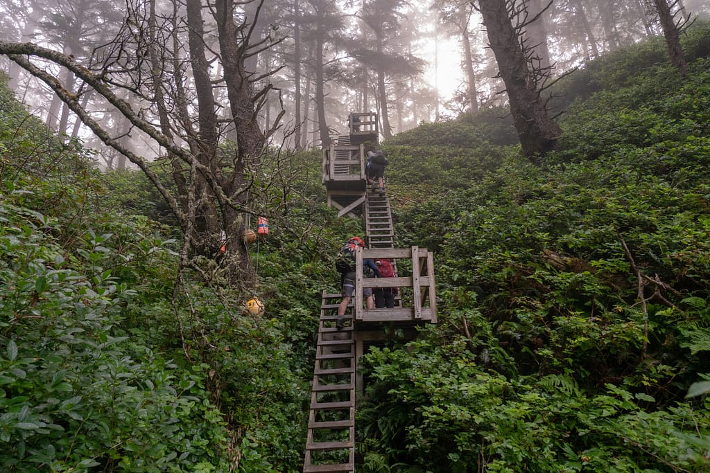
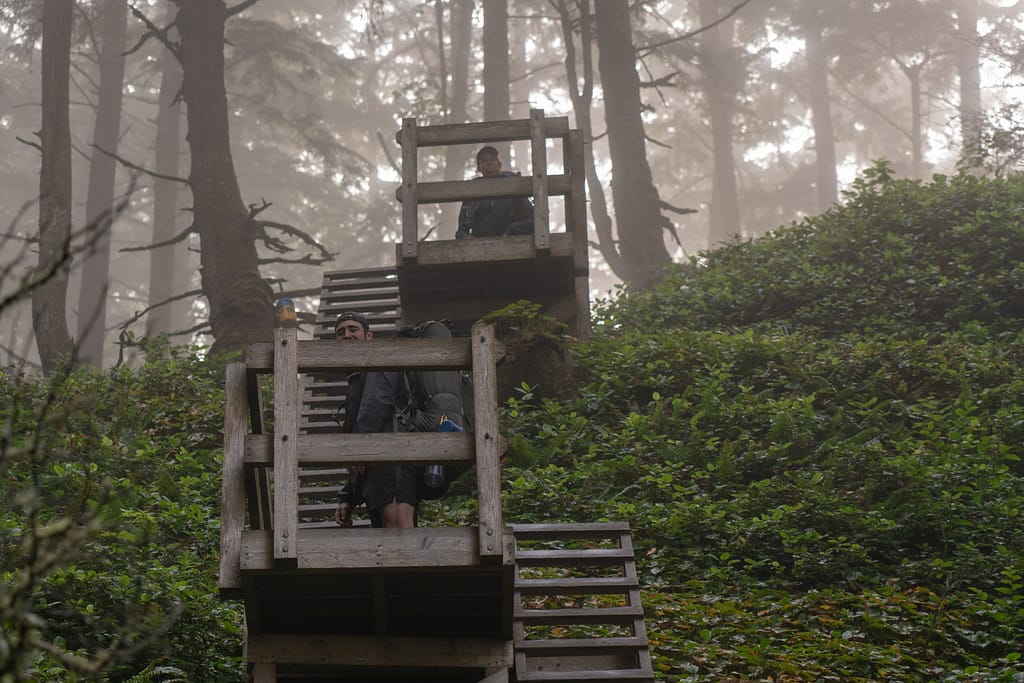
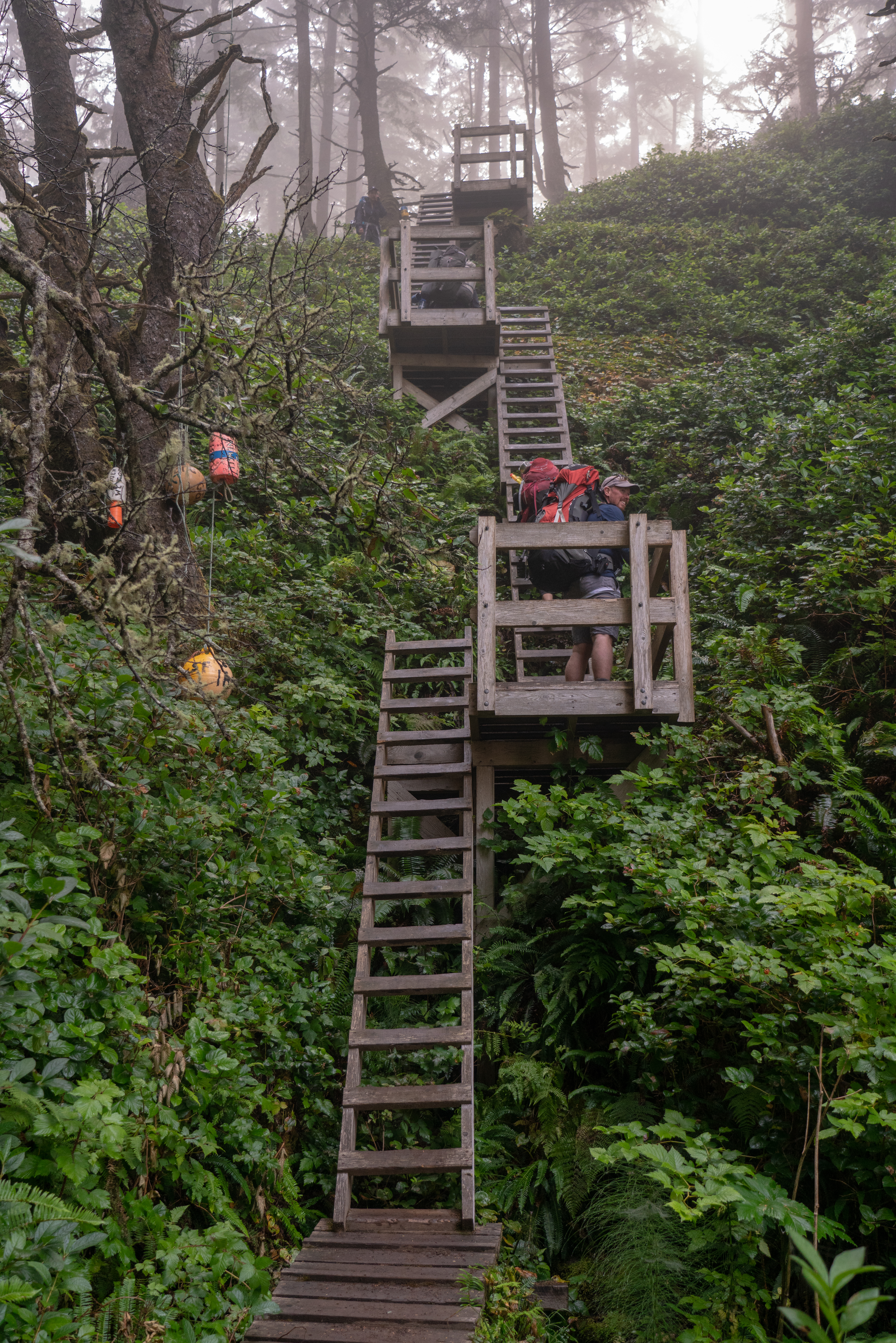
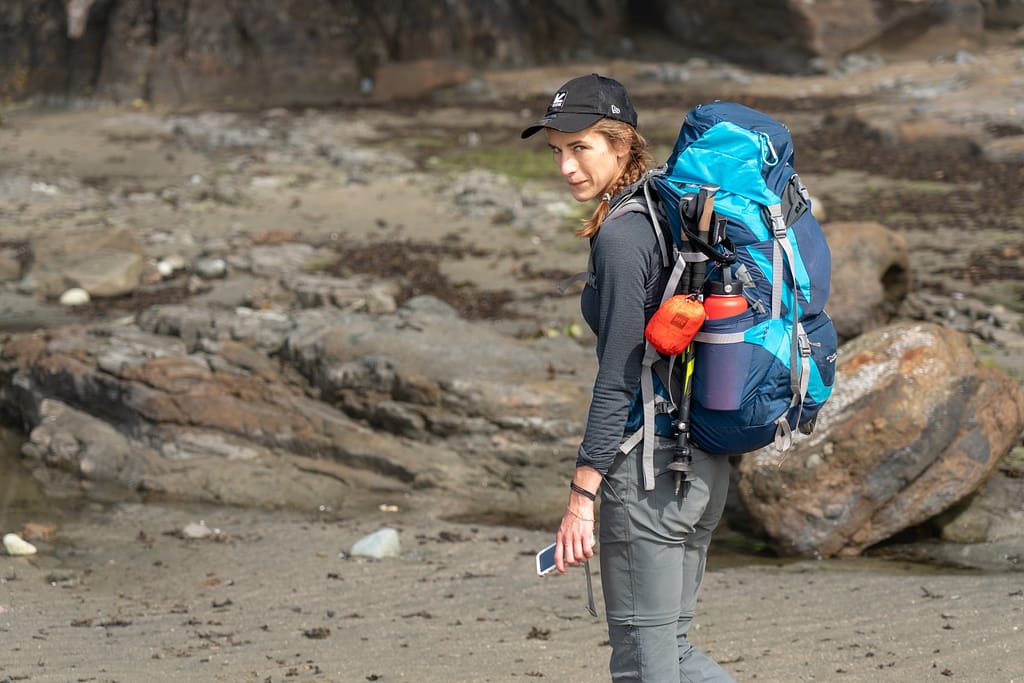
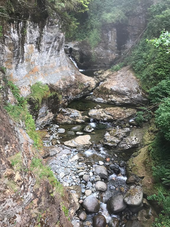
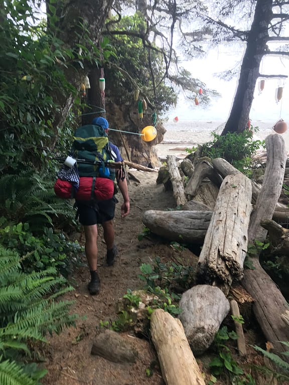
Up we go, and across the water source filling Tsusiat Falls. We paused briefly at the top to fill up our water bags and bottles. As we were about to get back onto the trail, Bill stepped one foot to far and was welcomed with a morning full of muddy boot. One would think he would be frustrated, but he is the exact opposite. Nothing short of a massive smile on his face and the comments “my waterproof boots are being put to use”.


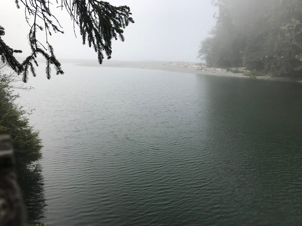
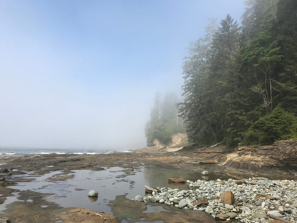
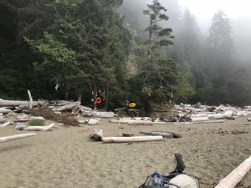
The view looking towards Tsusiat Falls

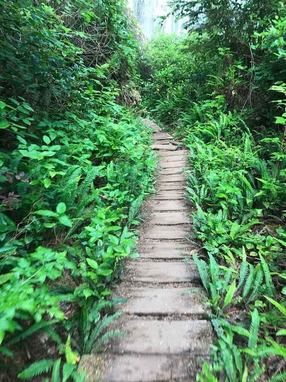
So we continue the trek along the broken boardwalks. (back to my tracking of KM) At 9:08 we pass WCT KM 25. The walk at this point is along some broken boardwalks and a few muddy spots. The trend seems to be, good boardwalks or broken boardwalks and mud. I make a personal note, time has started to feel irrelevant.
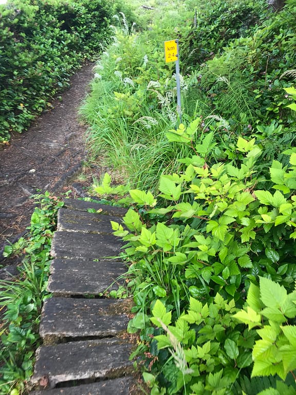
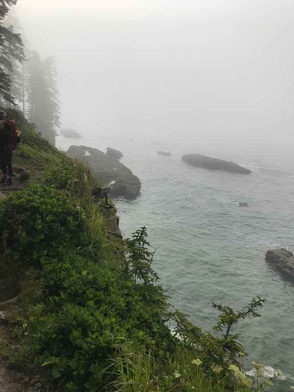
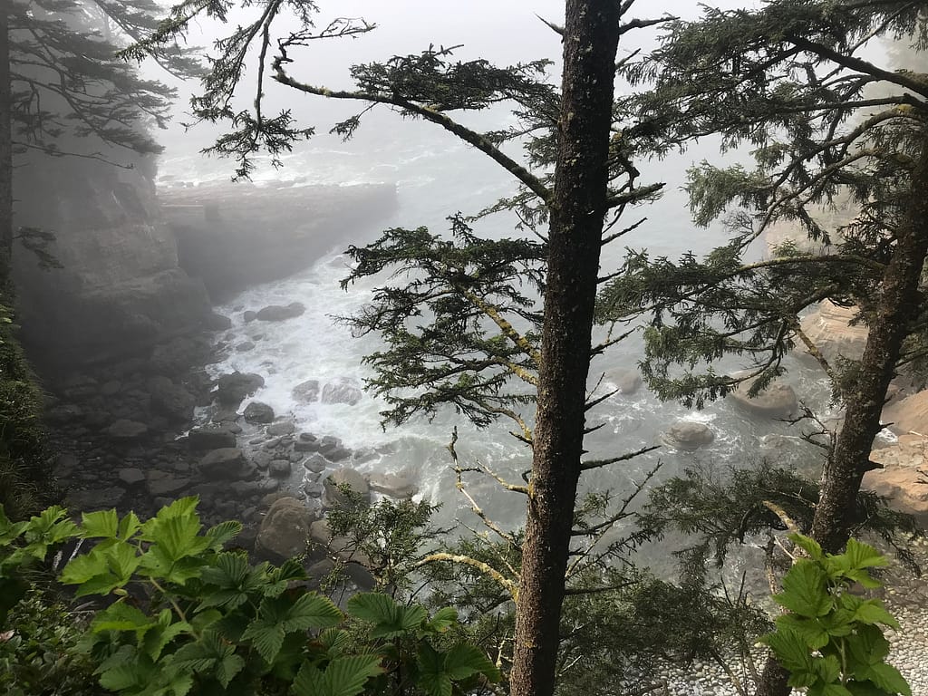
WCT KM 24 at 9:21. Beautiful look out point to see the ocean down below. We continue the walk up high along the ocean ridge line and then down and along the boardwalks.
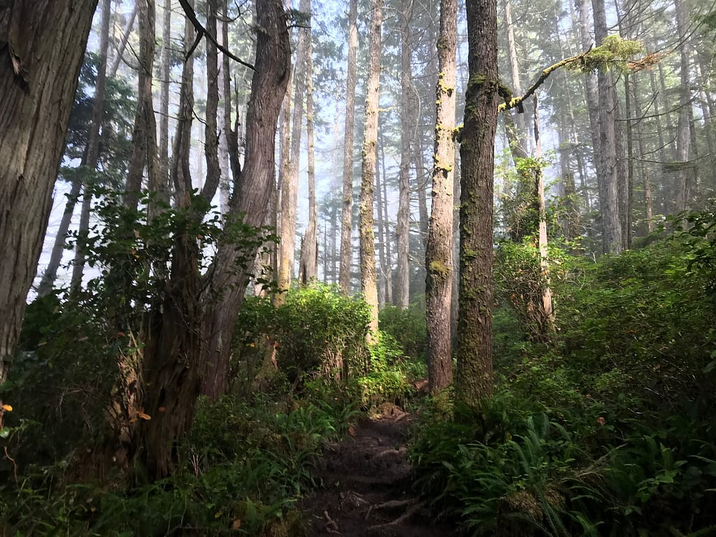
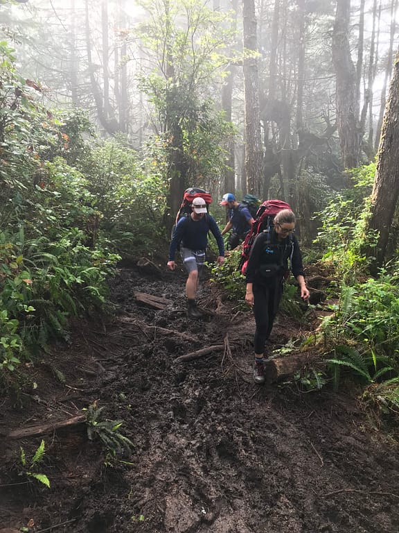
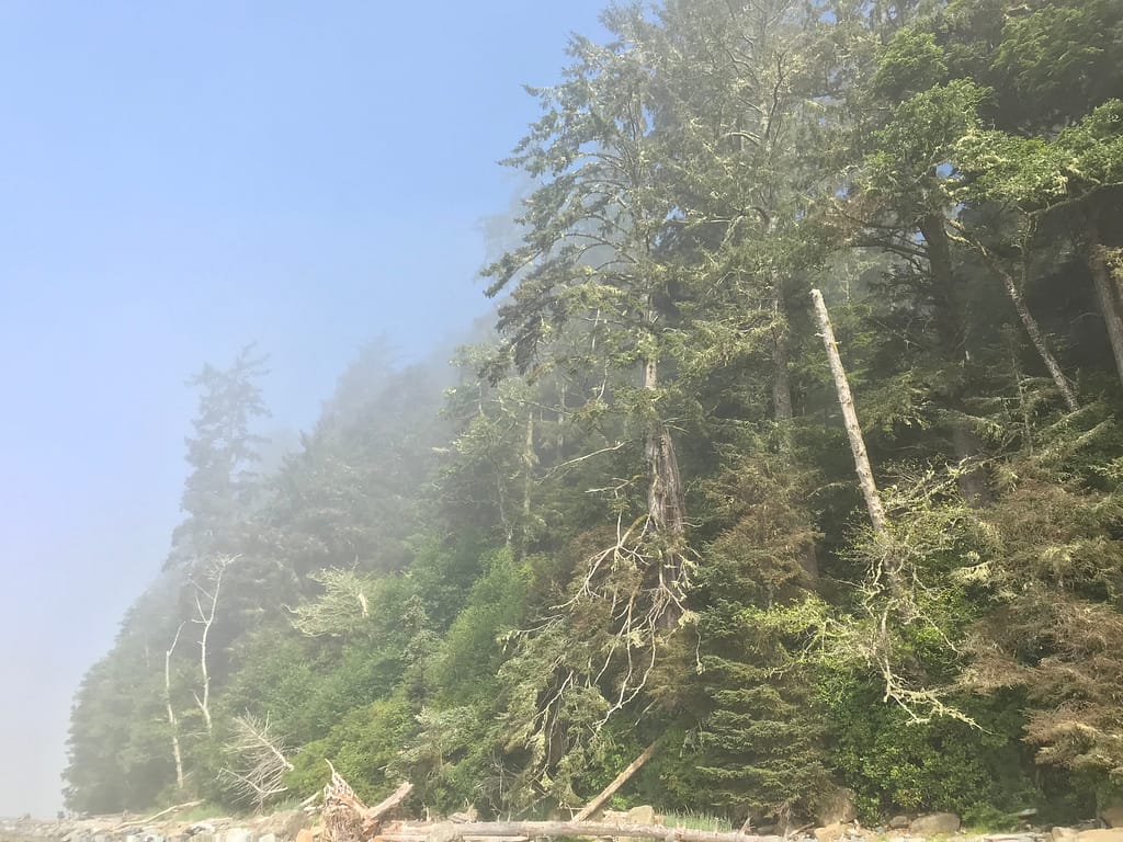
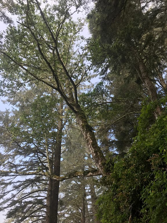
The sky line and tree’s were beautiful this day. As the sun was making a serious play to come out and shine. It made for an incredible visual experience. It is funny how muddy the trail is when there’s been a dry spell for a few weeks. I do feel for the groups that do that do this in the rain. The question in my head, how does the parks board determine what sections of the boardwalks get replaced and which ones are put on the list for the near future. We continued out walk on newly built boardwalks and passed along ones in a less than desirable state. For the ones recently built, it felt like an easy stroll in the park.
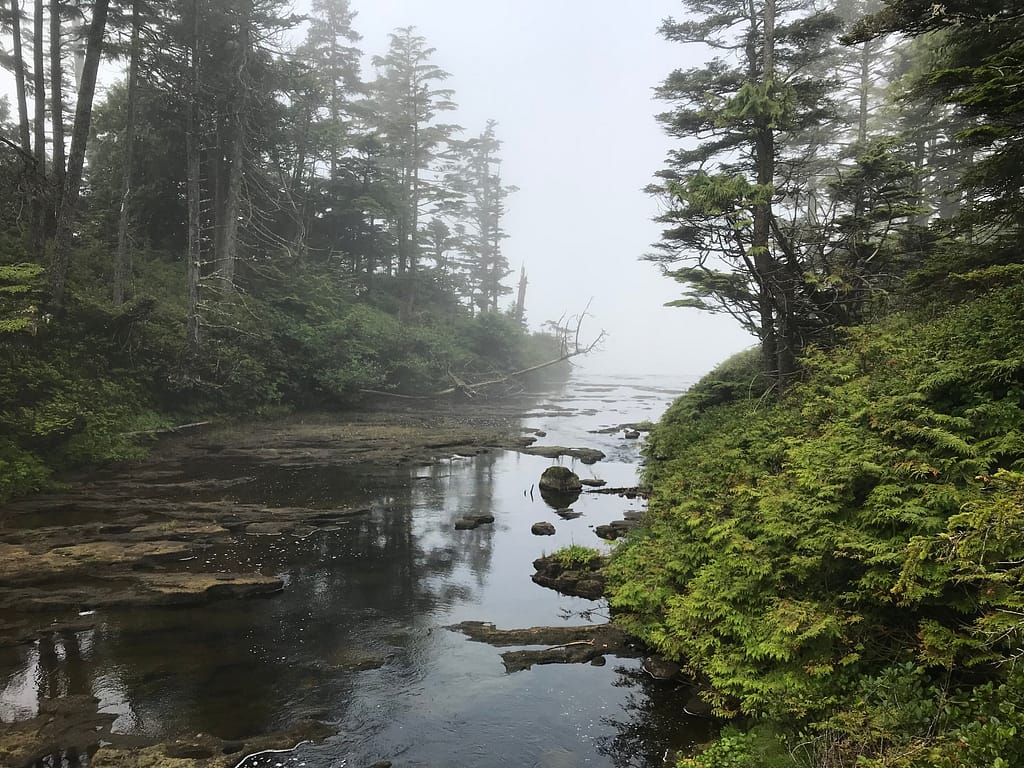
Per my norm, at 9:48 we passed WCT KM 23, and we approached the outlet of Klawana River as it merges into the Ocean.


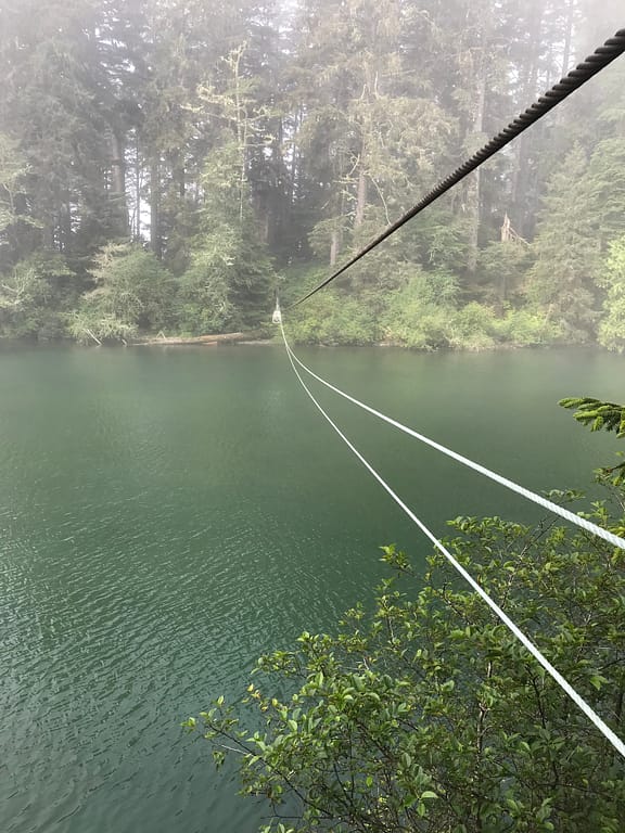
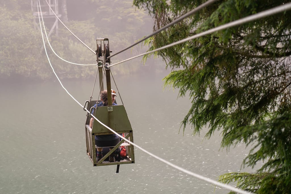
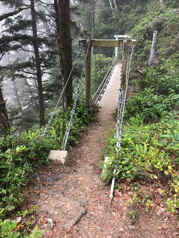
We reached Klawana river at 9:56 and looked on at the VERY long cable crossing. It was a fun one, where you pick up some good speed!
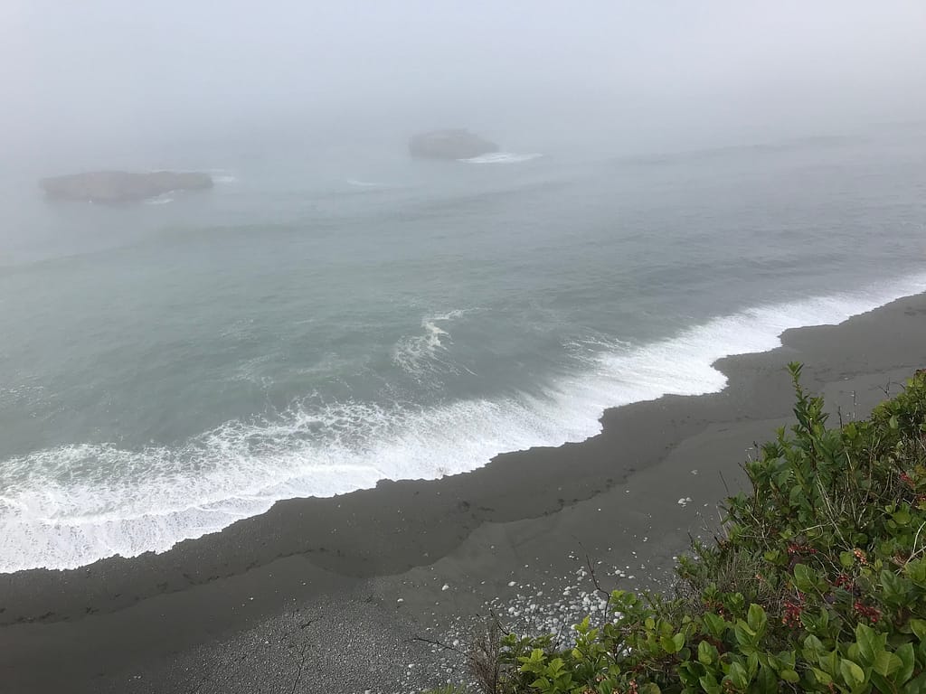
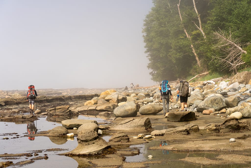
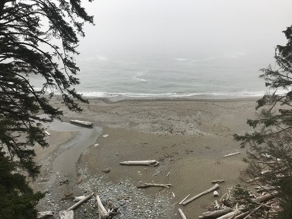
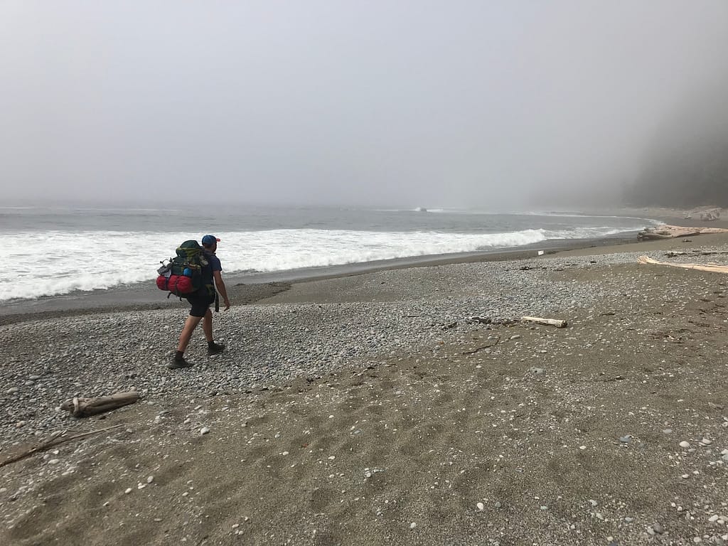
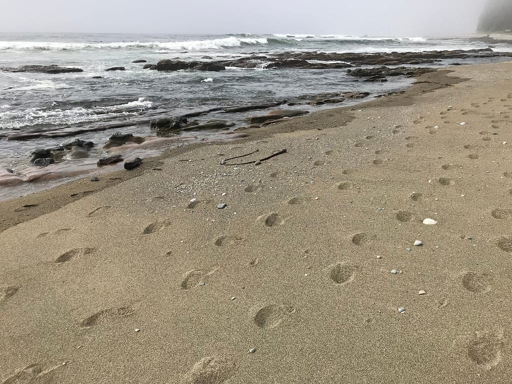
10:08 we connect back onto the beach. Its one of those rocky + pebbly beach. Leg workout = extreme. Continuing along we break at 10:20.


The beach environment has yet again changed into a rocky shelf and the never solid ground beach. Continuing with the walk, we move towards the rocks with the tide out as this seemed easier than walking on rocky sand. There were also some small sections of rock climbing. The sun was teasing us from this point on.
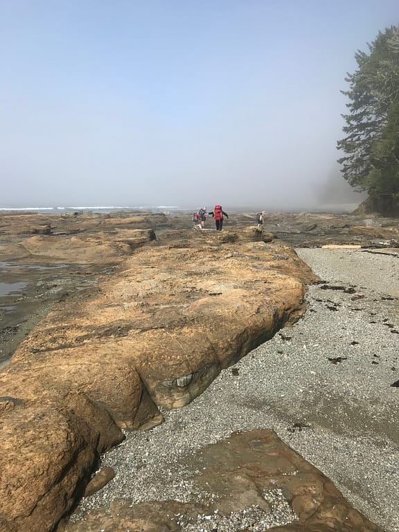
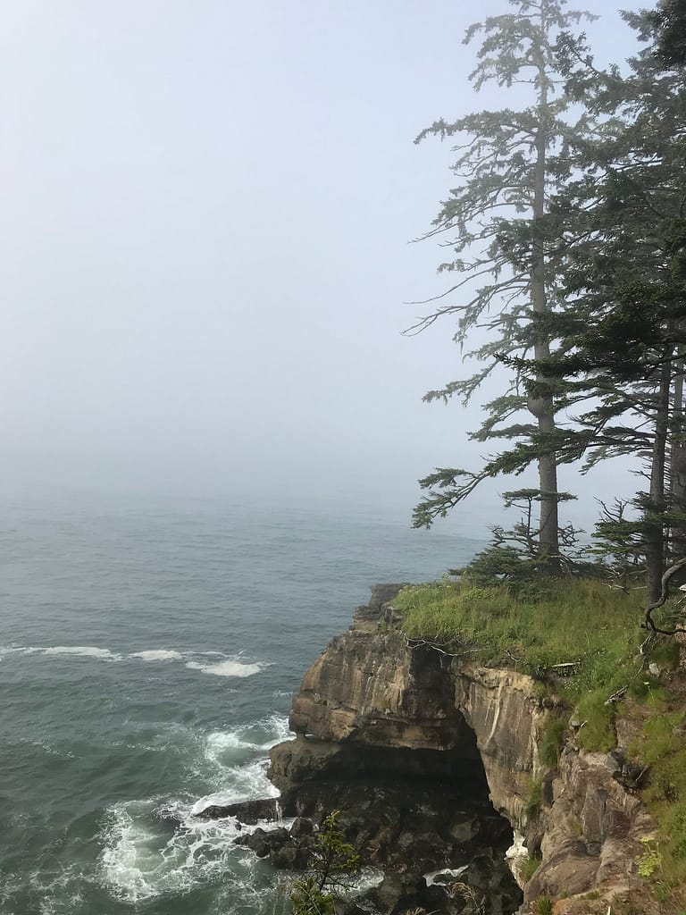
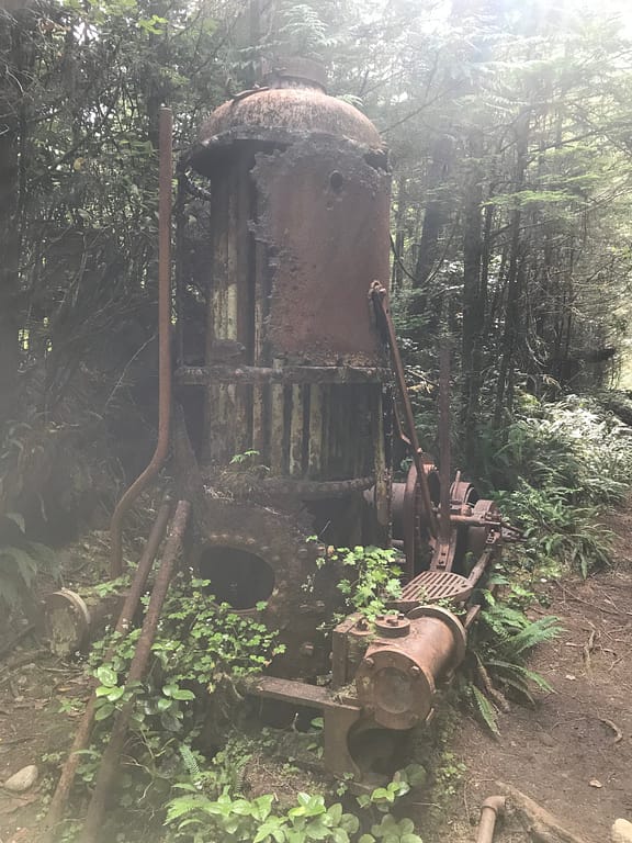
10:58 back into the forest. Walking along the cliff side. Beautiful lookout views to our left as we continued along. Came across another old trolly machine.
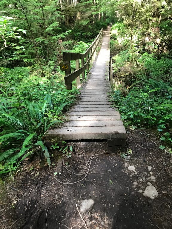
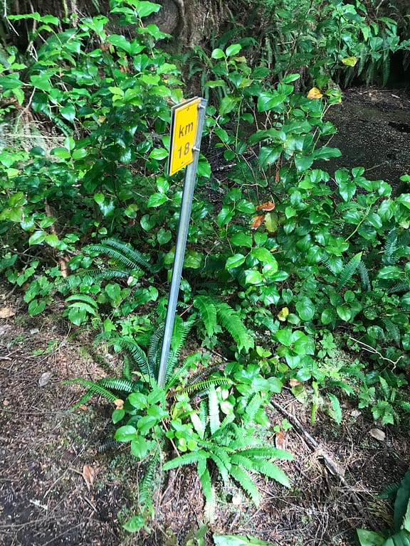
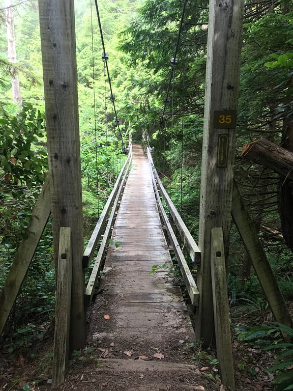
WCT Km 19 at 11:16, more forest + boardwalks, then bridge 43, forest, then WCT KM 18 at 11:32, boardwalks, 11:37 bridge 35, them WCT KM 17 at 11:46.
11:50 we took some steep ladders back down to the beach. KM = 8.5 of the day. 2x ladders + a bridge over a waterfall, and then another ladder down. And at this point, we learned from another hiker that one of the beers we lost back on Day 4 had washed up to the shore and another hiker enjoyed it. Awesome highlight of the day!
12:03 at the beach and we opted for taking a break. Side note ==> totally recommend staying at Tscowis Creek by the waterfall. It’s a less busy spot and incredible gorgeous!
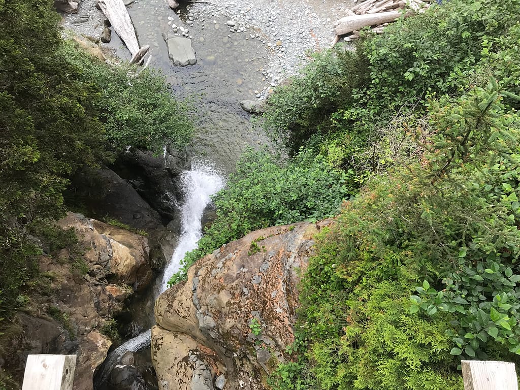
12:20 we continued along with our beach walk. The sand sinking heavily below my feet. Heading north towards the next place to possible camp along the beach Orange Juice Creek. Or as I like to call it “driftwood beach”. There’s a beautiful little waterfall you can fill up water at once you climb up and over the drift wood maze to get there.


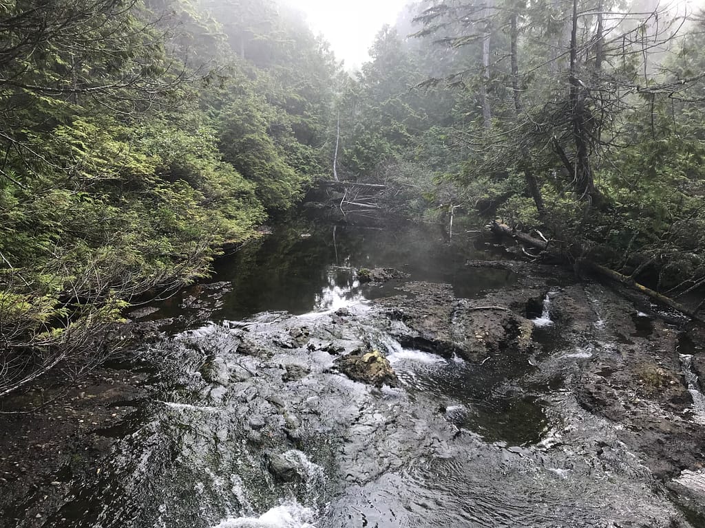
After a water fill up, we head along the beach and continue on our way heading to Darling River. As we approached Darling River, we opted to take a break at 13:09 mainly to drop our bags and walk up the river towards this beautiful waterfall with sunshine which fell just outside of the fog zone. One of the oddest moments of mother nature I came across as we walked from the foggy beach walk, up a river towards the forest and entered into sunshine. It felt surreal. If we were not set on having an easy last day tomorrow, I would totally recommend camping out at Darling Creek. It was a beautiful spot with a gorgeous waterfall and scenery.


After enjoying the sun, at 13:39, we walked back towards the foggy beach to continue north to find our camping spot closer to Michigan Creek. At KM= 12.23, we passed a small creek between Darling River & Michigan Creek. Then another water source. The scenery was stunning! With the green moss and the moisture floating off the rocks with the tide being out.


As we continued moving forward, we eventually reach Michigan Creek at KM = 12.9 of the day. Since we were going the opposite way, we had to take our time finding the perfect spot. Fortunately we did. On the far north side of the camp area. We set up camp, now in our expeditious fashion. Made our campfire living room. Although, the hunt for wood was an endless activity. (it’s a busy campsite, so the drift wood gets used up by the campers quite quickly).
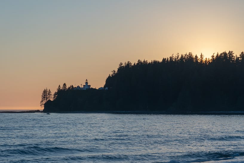
Highlight of the evening = the sun broke through and the fog was gone. This made our last night incredible. The beautiful beaming light of the sun. The gorgeous views of the ocean and nothing beyond. Starring at the waves crashing against the rocks was endless. And as the sun went over the horizon, the sky just lit up. We were very lucky that mother nature decided to give us an incredible last night!
Fun fact – bear activity was at a high at this campsite as well. Black bear was north of our campsite, just before the first hump before Pachena Point.


Day 7 – Tips/ Keynotes
- Michigan Creek is a busy campsite. Mainly because, going North to South it is the first campsite you can stay at. Finding fire wood can be a pain as the site is typically pretty sparse. You’ll need to walk north up the beach line or back track south to get some good fire wood for the evening.
- If we had time on our last day and were not worried about making it back for the bus, I would recommend staying at Darling River.
Reply
You must be logged in to post a comment.