Brunswick Mountain Facts
Brunswick Mountain near Vancouver, BC, is the highest ridge within the North Shore peaks. It’s summit is just north of Mount Harvey, which means epic 360 views. The hike shares the same trail head at Lions Bay, which also leads you up to Mount Harvey and the Lions.
Quick Summary – switch back’s take 1, veer off – creek crossing, switch back’s take 2, summit climb. The last climb to the summit is steep, open and rocky. Be prepared to feel the effects on your muscle the days that follow.
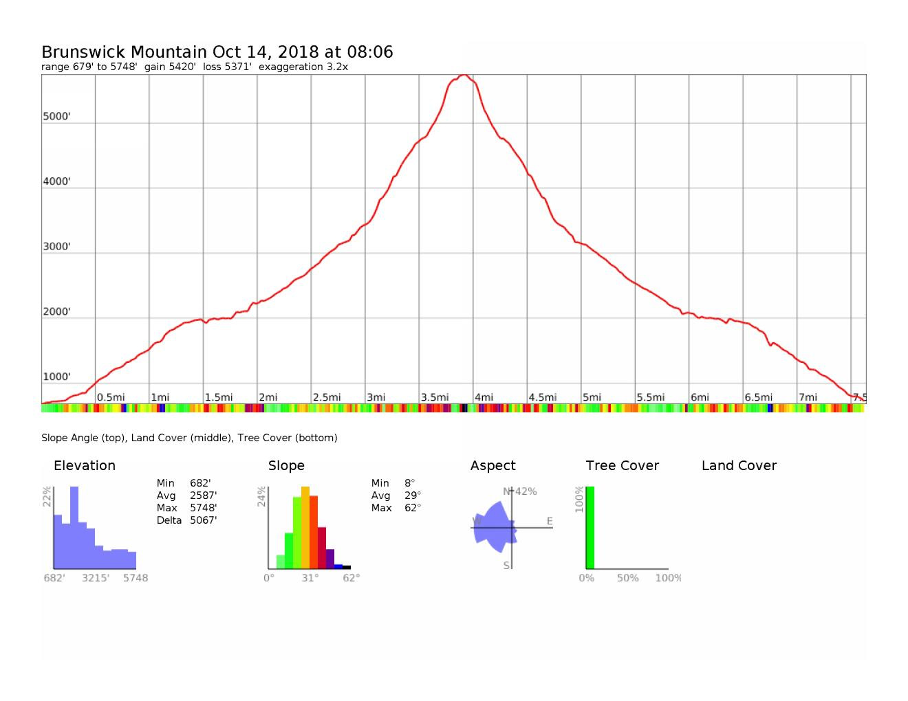
Distance: ~14.5 km (9 miles) Roundtrip
Time: Allow 7.5-9 hours Roundtrip (HK Hiking Time – 5 hrs 19 min R/T; Total Time 6 hrs 1 min)
Elevation Gain: ~1550m + (5,100 ft) – although depends where you park
Max Elevation: 1788m (5870ft)
When to do the Hike: June-October (depends on how fall turns out)
Overnight: Yes; but can be done in a single day; multi-day can occur too
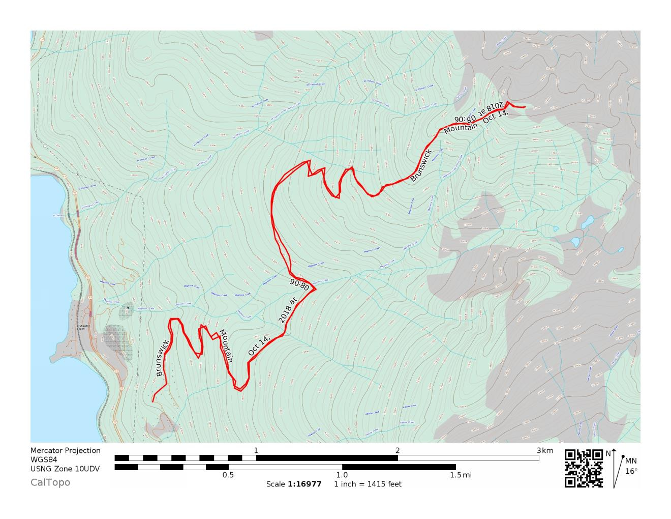
Map of the Route & GPS data: Yes!! Click here for Route or via Viewranger
HK Plan: Day Hike
Note: This hike is short and steep. It’s dog friendly, however only to the first summit. Towards the end of the season bring lots of water with you. There’s no options for fill up past the Magnesia Creek.
Part 1: Switch Back’s – Take 1
The trail head is at 49 28 15 N, 123 14 05 W – which is essentially Sunset Drive gate. [click here to input into Google Maps & make your life easier] Usually there is pay parking at the parking lot by the trail head. When we were last there, the pay machine was temporarily removed. Probably a result of the machine not properly accepting credit cards (from a previous trip). The lot can fill up with over-nighter’s so street parking may be you next resort, which can be sparse. (There’s a lot of No Parking June-Sept signs posted on the roads leading up). The earlier you get to the trail head, especially on weekends, the less of a headache you’ll have.
Through the gate, you head up along the logging road. Steep incline of switch backs lays ahead. You pass the first fork and continue up. Then you veer left at the next junction. There are signs indicating left for Brunswick Mountain, and right for Mount Harvey/ the Lions.
Heading north along the trail, you get a brief break from the switch backs with a nice, some what levelled path. As you make your way through the overgrown trail, you eventually cross Magnesia Creek. There are multiple branches off this creek, however the main creak is your last chance to fill up on water. Depending on water levels, you can cross the creek. There is a log bridge with a one side rope “guardrail” that can be used to cross the creek.

As you pass magnesia creek the trail stays pretty mellow. Watch out for the fallen trees and leftover holes from their roots. There is a fork another fork passed the creek. Make sure to stay to the right. (Left takes you to Hat Mountain / Tunnel Bluffs). An hour later…

Leftover hole from a fallen tree 
The easier path along the trail 
Signage indicating this way for Brunswick
Part 2: Second Set of Switchbacks / Forest Incline – Take 2
The fun re-begins. Some nice steep incline up into the forest. First you have the steep switch back’s which rise fast and quickly. The easy ground to walk on then transitions into a steep, forest filled path. We started off early enough, that I felt I was re-living the first climb. Then you reach a bit of a clearing and you see Mount Harvey to the south, and a teaser of Brunswick in front of you. At ~ 1520m, there is a 4-way hiking junction that intersects multiple hiking paths. One mainly with the Howe Sound Crest Trail, and smaller trips which connect you to Deeks Lake or to the Lions.

Looking up at Brunswick Mountain 
The steep slopes of Mount Brunswick 
The beautiful fall colours 
The view looking over to Mount Harvey 
Happy Jack 
The 4-way hiking junction
Part 3: Summit Climb
Past the 4-way hiking junction, its summit climb. Oh soo much fun. It’s rocky, steep, at some spots sketchy, well mainly just take you time and set your own pace. Note – if you have a dog, you should put them back on lease at this point. There are some steep cliffs along this final section up.
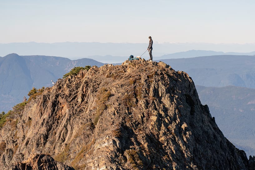
There’s a saddle on you eventually come up on to. Also, a beautiful spot to camp over night. Head to your right along the ridge to land at the west peak. If you have a dog, it is NOT recommended to continue to the true summit. I stayed back with Jack, while K went over to the true summit just down and along the ridge. The view on top is incredible. You have this perfect 360 panorama of the surrounding area. Photos do it mild justice, so see the following gallery.
Key Tips/ What to Bring:
- Bring 1.5 L min of water if the suns out. Later in the season there are minimal options to fill up along this hike. Nalgene Water Bottles are a great option.
- To fill up water at Magnesia Creek – recommend using water tabs or a small hand filter.
- If you have poles, recommend using them on the way down to minimize the impact on your front leg muscles. If no poles, I recommend buying these (helps to saves your knees and muscles the next day).
- The summit climb is very exposed, so be prepared if the sun’s out.
- The hike can be done in trail runners or hiking books. I prefer hiking boots w/ ankle support (due to previous knee injury) – currently using Salomon Quest4D2GTX hiking boots. K prefers the trail runners – he’s currently using the Saucony Peregrine trail runners.


Reply
You must be logged in to post a comment.