- Date Completed: Friday 2018 July 20
- Distance (According to GPS): 8.64km
- Time: 6 hr 15 min
- Elevation Gain: + 524m – 499m
- West Coast Trail KM’s: KM 70 to KM 62
- Map of the Route & GPS data: Yes!! Click here for Route
- Best Description of this Day: Team Wooden Fish


I’m a bit old school with tracking our adventures in my Moleskin Notebook.

Day 2: Thrasher Cove to Camper Bay – 2018 July 20
5:30ish Wake Up, Pack, Coffee, and Go
Day 2 we decided to stick with the grove of waking up early and getting on the trail first. We took this approach going forward as we found you have those less awkward moments when you are trying to pass people, or people are trying to pass you.
TIP: You and your group will begin to get into a morning pack up routine as the day’s progress. Keep in mind coffee = key. As for myself, I tend to avoid conversations before the morning cup of joy.
Tents packed and a last refill of water at the creek.


7:20 Thrasher Cove to Owen Point
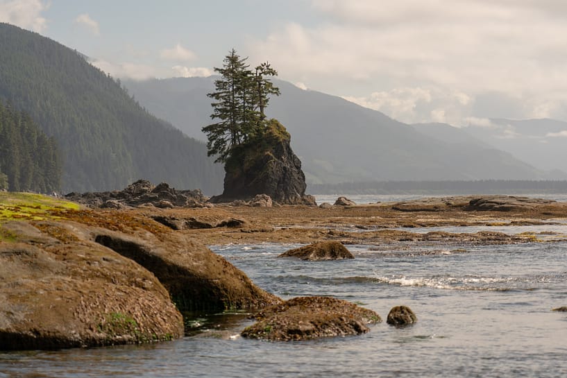
Hello Boulders! From Thrasher Cove, the first stretch of the terrain leading up to Owen’s Point is rocks, boulders and even bigger boulders. To complete this stretch you require the tide to be blow 2.4m. Otherwise, you will be wet. This section is slow as a result of having to create your own path through the every evolving boulders with dynamics that change daily/ every high tide.


The scenery is beautiful as you progress along this portion. Our group enjoyed the climbing of the rocks, it helped pass time as we slowly progressed along and there were many jokes of “parkour parkour”. There are lots of tide pools to bide your time while you break or wait for group. And the drift wood was ridiculously large. I often wonder where half this stuff floats from… 9:01 we took a break just across from Kellet Rock. Shortly after at 9:14 / KM = 1.70 of the day, we took a break on this random beach with a wood swing. This looked to be a lovely space to camp if your tide timing worked and you wanted to be at a less busy camp site. Note – there was no water source at this location.


9:46 / KM = 2.60 slowly approaching Owen’s Point, we reached an incredible beach with a waterfall (fresh water source) where we filled up on water. We also realized the rock climbing had come to a conclusion. Sandy beaches hopefully ahead?! The landscape on this beach is transformative. The scenery completely changed into a different environment. The green sea grass on the sand with the tide out tricks the mind. Slogging along the beach, we got the lovely experience of passing a dead sea lion. (the smell ….soo bad!) Once I team recovered, we approached the caves. ABSOLUTELY BREATHTAKING!


10:00 Through the Caves and Around Owen’s Point
The caves are a site to see. We got some time to explore around as were a bit early to Owen’s Point for the low tide. Are eagerness with waking up early, caused us to sit back, enjoy the view and watch the sea lions basking in the sun on Owen Island. So bags dropped we took in the view as the tide continued out, so we could make the hop up to Owen’s Point.
I could try to describe the caves and the majestic scenery, however just take a look at the photos to understand my level of awe.


10:30 Owen’s Point to Beach Access A
This portion of the trail was probably my favourite. Mainly seeing the rock formations that mother nature forged. After waiting a few moments we shuffled the backs up the rock creation and hoisting one another up.
NOTE: The rocks to access Owen Point and the ridge that you jump up to are slippery as can be. Make sure the tide is below 1.8m and take your time.
The view on top of the rock shelf = completely different. My mind was enthralled with the drastic change in the scenery and this colourful walk ahead on top of the surge channels. Breathtaking view with the waves crashing into the shoreline.


- As we continued along, you get a sense of being transported to a different planet. First thought being Mars’ craters.
- Keep an eye out along the surge channels. A few of them should not be crossed, even if the tide is low. There are flagged routes to take you up and around them.
- Around KM= 3.73 / 11:00 we passed the access point that takes you up to get water at 150 Yard Creek.
- The natural rock formations change as continue along this shelf walk. Changing from a crater shelf- like scenario to a flat stretch of rocks in line with sea level
- 11:30 ish/ KM=4.5 of the day we passed Beach Access Point B – there was a ladder and a “B” clearly labelled on the rock beside it.
- 4.5 km’s progress by 11:30…. as I said the ever changing terrain is slow to maneuver. But the views along it are incredible.


- We approached this eroded corner, where the exposed face of the cliff makes the mind think the trees above us are about to fall down. How those trees are growing is a puzzling one.
- KM = 4.95 / 11:45 we turn the corner and opt for a break on this sandy/mossy beach before we make our way up Beach Access Point A.
- 12:17 we head up the brief ladder at Beach Access Point A. NOTE: you are forced to go back up to the forest route as continuing down the beach brings you to a halt at the impassible headlands.


12:20 Beach Access Point B to Camper Bay
- Into the jungle we walk. Think tropic thunder forest action scene. Along the boardwalks we teeter along. 12:21 we pass the WCT marker #65.
- The walk through the forest was beautiful and fresh. Lots of changing environments with lookouts to the ocean below and boardwalks, ladders and tree’s turned into bridges.
- Our pace in definitely picked up speed due to the easier terrain. we crossed Bridge #93 at 13:07 / KM= 7.6 of the day.
- And more ladders / boardwalks and trees turned into bridges. The boardwalks are very convenient, especially if you completing the hike in the rainy season and there is lots of mud.
- 13:42 = the ladder descent down into camp.
- The water level at Camper Creek was super low so we did not need to utilize the cable car.


13:45 Set up Camp and Chill
Camper Bay is a pebbly beach surrounded by Camper Creek, with the ocean a short distance away. We found a spot which inadvertently turned into a central, crowded spot later into the afternoon. Our Camp set up was on par, however in our reflections of the day, we all agreed we would have chosen a spot that was a bit more secluded and closer to the ocean.
Tents up, fire wood foraging complete, epic camp set up in place, did some laundry and got the menial tasks that needed to be completed done. This allowed us to have some fun and continue our wood carving/ boat regatta. Camper Creek is super calm and ideal for a boat race. We enjoyed a lazy evening. Viewed the waves crashing up onto Camper Bay as the sun began to set.
Then zzzzz time.


DAY 2 – TIPS / KEYNOTES
- Bouldering = go slow and poles are super handy
- Sunscreen, hat and lots of water are key along this beach portion. It was a clear day for us and we definitely felt the heat as we were exposed the entire time.
- When you climb over Owen’s Point and the tide is not fully out, have one person climb up first and then pass the bags up individually. This is much easier to climb up and over when the weight on your back is gone.
- Camper Bay – can get very crowded at the mouth of the creek near the cable car crossing. If you are a light sleeper – ear plugs come in handy at this spot. Alternatively, go towards the and cross the creek to the pebbly island and enjoy a more secluded away from the masses.
- Laundry at camper bay can be problematic in the main camp area by the cable cars as the sun sets disappears in this area quite early so to Camper Bay being recessed back away from the ocean. Leave laundry to Day 3 if you can. Key Laundry Supplies – soap, pegs, rope.
- Main campsite fills up super fast around 16:00, so if you want an optimal spot arrive early.
Reply
You must be logged in to post a comment.